High Spur slot canyon contains the most beautiful sections of slot I've ever seen. The canyon slots up nicely right off the bat, alternates between open and slot, and finishes with a breathtaking finale. It is a perfect canyon for beginners with relatively easy obstacles to overcome.


It is located deep within Robbers' Roost (60 miles on dirt roads and about 2 hours off the highway deep). We left Provo at 7:30 Saturday morning and got back at 11:30 at night. Total hiking time from when we left the car to when we got back to the car was six hours. We explored a few side canyons and took a few breaks including an hour break at the last rappel. If you were to hurry and just go straight through, it could possibly be done in as little as four hours.


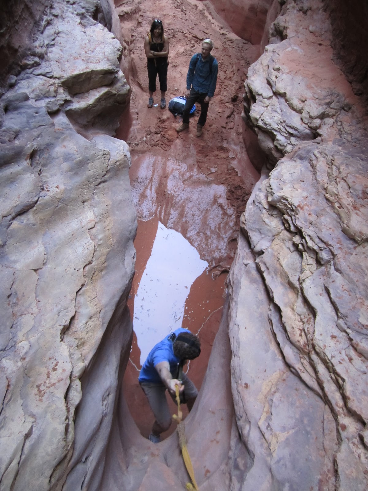
As far as obstacles go, there was a 15 foot drop halfway through with water at the bottom where you could rappel or just use a hand line to let yourself down. There were anchors already set up, but the webbing was in pretty bad condition. There were a few five foot downclimbs throughout, and one dry pothole in the "Corkscrew" section that was possible to escape on your own and would be a piece of cake with someone helping. Immediately preceding the final rappel was a 20 foot dryfall that we downclimbed. There were anchors in good condition that could be used to set up a quick rappel. The last rappel was over an 80 foot waterfall with two hundred foot cliffs rising around on almost all sides like an enormous silo (first picture).


High Spur is rated 3A III using the canyon rating system which means it is mostly dry in normal conditions. It hadn't rained recently, but we had to wade in ice cold water up to our chests.


Directions: (For GPS waypoints, join the circle of friends at climb-utah.com)
Take I-70 west from Green River 11 miles. Take Hwy 24 toward Goblin Valley/Lake Powell/Capitol Reef. Half a mile past the turnoff to Goblin Valley, turn left on the road signed Rooster Flats and Hans Flat Ranger Station. Go 24.3 miles to an information kiosk and turn right (south) toward Hans Flat Ranger Station. After 6.9 miles, stay left at the fork. Continue 14.2 miles to the Hans Flat Ranger Station. This last section may be passable in a passenger car but would not be easy. Once at the Ranger Station, turn left (north) toward Horseshoe Canyon. Go 12.8 miles to the signed Deadman's Trail on the left side of the road. Park here just off the road and follow the small unmarked footpath south for half a mile to the entrance to the canyon.
The exit is quite a hike. Half a mile after the last rappel, take the 4th class exit on the right side of the canyon. Once you've reached the top, work your way east cross country. You'll eventually need to climb the hills to the northeast and keep working your way northeast until you reach a 4x4 road (Deadman's Trail). Follow this road two and a half miles east back to your car.
Video courtesy of YouTube user calebsl1.
Subscribe to his channel!
Subscribe to his channel!
No comments:
Post a Comment